Scan to BIM is not CAD to BIM
Today we briefly share our experience with Scan to BIM for asset digitization:
Over the past 2-3 years, we’ve #digitized more than 500,000 m2 of industrial, logistical, #retail and historical buildings using laser scanning and point cloud technology, working interchangeably with FARO Technologies and Leica Geosystems part of Hexagon and their #softwares: #scene, #register360.
Therefore, this extensive experience has provided us with a unique execution capability, and what we’ve learned is that these scanning processes and their subsequent #BIMModeling require a much wide complex #proyect preparation and study than any other, as well as a committed and diverse team with various skills.
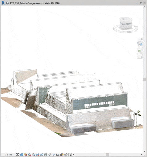
The ultimate goal is the digital model of the building with its current conditions, but the process must be fully considered to increase the value of all phases of the project, saving time, removing errors, and benefiting the client.

Point clouds of over 3,500 positions (in color) or models up to 300,000 m2 make you rethink a series of issues. As a result, we’ve summarized into 10 notes to consider when it’s your turn to undertake them:
- Knowledge of PPE (field data collection is physical work and requires close attention). You need to be fit because you’ll be covering some kilometers per day with the scanner! 😉
- You must study the operation of the place to be scanned (peak/minimal noise hours, areas with machinery, pedestrian walkways…).
- Familiarize yourself with special situations/zones: Machine rooms, industrial cold zones, boiler rooms, electrical risk areas, etc., and the necessary PPEs as well as the conditions for using electronic devices in these areas.
- Hardware: Use of Faro, Leica, Drone… each has its own possibilities and techniques. The information returned is completely different, and you’ll need to know about all of them… And, by the way, you’ll need very good equipment in the office to process all the captured information.
- Software and applications: You might end up in Recap (point cloud software), but the potential isn’t there. Remember you might have very heavy files.
- Programming: You’ll need it when the project/process gets complicated… And trust us, it gets complicated.
- Logistics: Moving a team of people with all the PCs and scanners to different locations for several days/weeks requires planning and foresight.
- Processes: Define an agile workflow that everyone on the team understands and follows daily with the scanner to ensure no areas are left unscanned. Take time at the end of each day to record the areas scanned and any problems or issues detected.
- Deliverables: Defining deliverables isn’t just about defining the format; you’ll need to know the client’s infrastructure and how they’ll use it subsequently, as well as future BIM uses and how they’ll be applied. Have you thought about how you’ll share the 100 gigs of point cloud data? :-\
- Collaborate: In projects of this scale and size, you’ll need support from the client. And since it’s impossible to know everything, you’ll also require it from other service providers or companies specialized in each field.

Scan to BIM conclusion:
Modeling based on a point cloud reference is a process that may end up being slower than modeling from CAD, but the benefits are obvious, as you have an updated and real source of information with maximum detail.
Over the years, we’ve seen how the #AECO sector has learned and improved in this area and it is now able to differentiate and value good data capture and registration as well as modeling and coordination for the use of BIM models. It’s a first step in its digitization, and we hope to be there for the next steps.
If you need #ScanToBIM to digitize your building and you don’t want to waste money on point clouds without color, without coordinates, or with shadow zones: contact us!
Related posts: “BIM in websites: how to export and visualize website BIM models”
Lo sentimos, no pudimos encontrar ningún post. Por favor ensaye una búsqueda diferente
